Tuesday, 16 August 2011

Sketchbook project 2 - Central line


I started travelling on the Central line at Oxford Circus at 10:42, and after visiting West Ruislip and Ealing Broadway in the west
and Woodford and Epping in the (north) east
got back to Oxford Circus at 16:42. (That included time for a sandwich and a bit of shopping in Woodford.) From West Ruislip to Roding Valley, the stop a couple of minutes before Woodford, the journey time is 87 continuous minutes; straight to Epping, it's 81 minutes.

The Central line is the longest line - 47 miles - with 49 stations, 20 below ground. It has a complicated history of extension from 1935 to 1957. The Central London Railway, running between Shepherd's Bush and Liverpool Street, opened in 1900; in 1937 it was renamed the Central Line. "One legacy of the line's building is that the sections under the City were built to follow the geography of the streets above, rather than underneath buildings, to take advantage of the free wayleave offered by the government. As a result there are many sharp bends and curves on the track between St. Paul's, Bank and Liverpool Street. At Bank station, the Central line platforms are so tightly curved it is not possible to see one end of the platform from the other and the traditional "mind the gap" message is particularly stressed here."

Thursday, 11 August 2011

Sketchbook project 2 - Bakerloo line

For the theme of "Along the Lines" my project is to draw/write each line separately, travelling the length of the line to the end, starting from a point in the middle. (For convenience.)

Each line is preceded by a drawing of it, extracted from the tube map. The Bakerloo line is the first in the alphabetical list. I started at Oxford Circus and went to Elephant and Castle, the southern end of the line -Then to Harrow and Wealdstone -
and back to Oxford Circus -

Another component of the project, though not part of the sketchbook, is photography. Most stations have a chart of train times, including a diagram of journey times - 11 minutes to Oxford Circus, 48 minutes to the end of the line -
Heading south, though, it should take only 47 minutes to get from Harrow & Wealdstone to Elephant & Castle -
Of the 25 stations on the Bakerloo line, 15 are underground. The Baker Street to Lambeth North section of the line was opened in 1906, and it was extended to Elephant & Castle the same year. In 1915 it was extended to Queen's Park. It ran north to Watford Junction until 1982.

The actual route of the line -

Friday, 20 May 2011

Waiting for the bus

Vauxhall. Click to enlarge.

Friday, 18 March 2011

Camberwell New Road

Taken from the 36 bus (it has an upstairs; sometimes the 436 comes along first - it's a bendy bus, upon which: no comment). Both have announcements of the name of the upcoming bus stop. It's not been long since bus stops had names - once upon a time travelling by bus was a mysterious process, but now there are maps and information all over the place - well done London Transport - oh, that's been renamed: Transport For London.

The photos are small, but don't you get a sense of what a colourful route it is? And now's my chance to find the names of the roads along the route - Kennington Lane, Durham Street, Harleyford Road, Kennington Oval, Harleyford Street, Camberwell New Road, Camberwell Church Street.

The photos were all taken along Camberwell New Road - a turnpike in 1818, it's now the longest Georgian road in England.

Sunday, 27 February 2011

Albert Hall to Hyde Park Corner

Rainy day; using zoom, at every bus stop.

Friday, 25 February 2011

Land line


Moorfields Eye Hospital to Old Street station.

Tuesday, 22 February 2011

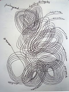
Finsbury Park to Vauxhall

"Writing lines" ... writing practice ...

Saturday, 12 February 2011

Highbury & Islington to Charing Cross

The circles derived from reading "Lines" by Tim Ingold:
The hub-and-spokes model of place (left) compared with the place as a knot of entangled lifelines (right). In the diagram on the left, the circle represents a place, the dots are its living occupants and the straight lines indicate the connectors of a transport network. In the diagram on the right, the lines are living inhabitants, and the knot in the middle is a place.

So, "being on the tube" is a place?

Thursday, 3 February 2011

Finchley & Frognal to New Cross Gate

Off at Dalston, pick up a coffee outside the station, short walk to Dalston Junction for the (uncrowded) East London line.

Monday, 31 January 2011

Map model

World map (cities are given three-letter "airport" codes) based on the underground map - one of many variations (see others here) by Chris Gray; available as a poster (£35) here.

Monday, 10 January 2011

Car journey

Mostly sewn without looking, on the way to Lower Heyford (Oxford canal).

Friday, 7 January 2011

"Thank you for holding"

Marking time while waiting for a phone call to be answered (it never was).

Tuesday, 4 January 2011

St Giles Church to Trafalgar Square

Circles = time sitting in traffic; dots = time at bus stops; x = bell. When the page was full, the young man sitting opposite said, "I think I've figured out what you're doing - but I didn't want to interrupt you to ask."

Finsbury Park to St Giles Church

First use of the doily format - with a change in the loops during announcements, and dots for being stopped in traffic.